Home / Things to do / Walks and cycling
Walks and cycle routes in Deal
Easy, mostly flat routes along the seafront and through the town, with maps, distances and times.
Recommended walks
Six walks around Deal, Walmer and Sholden, from an easy stroll along the seafront to a longer loop with a village stop. Times are approximate.
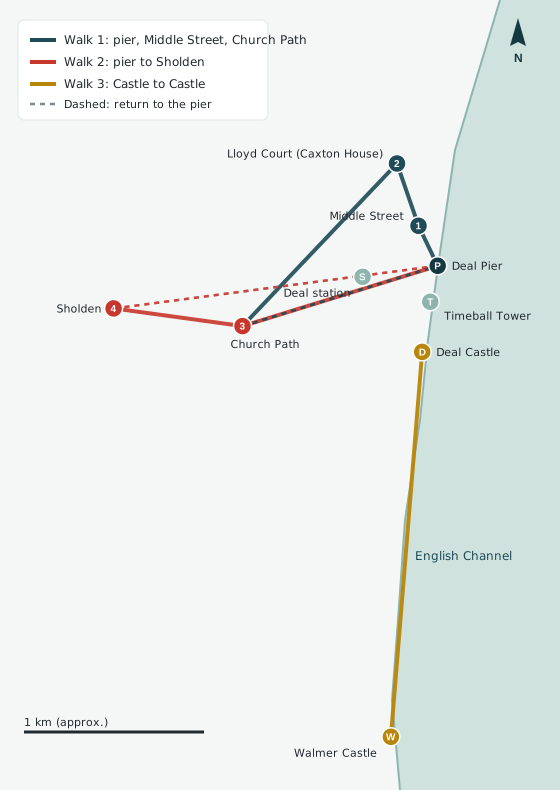
Interactive map: use the walking directions links below for each route.
1. The pier, Middle Street and Church Path
Start at the pier and head into town to Middle Street, with its Georgian lanes. Continue past Caxton House (now Lloyd Court) to Church Path, then return to the seafront to finish.
2. The pier to Sholden
A longer loop with a village stop. Follow Church Path to Sholden village, then walk back along the seafront to the pier.
3. Castle to Castle along the seafront
Start at Walmer Castle and Gardens on Kingsdown Road. Follow the seafront path through Walmer and into Deal, passing the Millennium Milestone, and finish at Deal Castle on Marine Road. You can carry on to Deal Pier, or take the train from Deal station.
Easy and flat with no steep cliffs. Suitable for families and wheelchair users. Dogs must be on a lead. Check English Heritage opening times before you set off.
Heritage walks
- The Blue Plaque Trail (about 2 miles, around Deal). Details and the route are on Deal Heritage.
- The Royal Marines Heritage Trail (Deal and Walmer, length not stated). Route details are on the Royal Marines Heritage Trails website.
- The Historic Town Trail (town centre). Download the leaflet from the Deal Town Council website.
Deal Town Council lists ten circular walks of 2½ to 8½ miles around the town in its Walk Information leaflet.
Recommended cycle routes
Easy, mostly traffic-free rides through Deal and Walmer, from the seafront to the town's quieter streets.
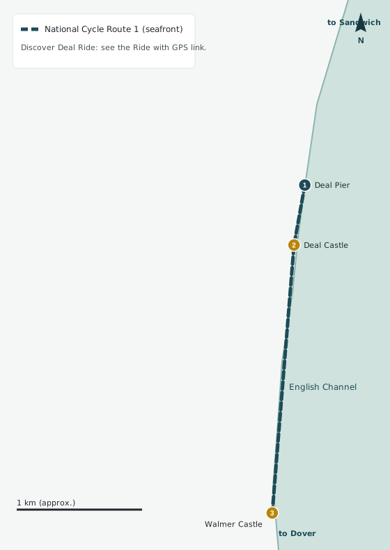
Interactive map: use the cycling directions link below.
1. National Cycle Route 1: the seafront
National Cycle Route 1 runs along the seafront from Deal Pier, traffic-free and mostly flat. Heading north, it leads towards Sandwich and Canterbury. Heading south, it leads towards Walmer and on to the White Cliffs and Dover.
2. The Discover Deal Ride
A short, gentle ride through the streets and pathways of Deal and Walmer. The route map and cuesheet are on Ride with GPS.
3. Cycle and walking map of Deal, Walmer and Sholden
Deal Town Council's map shows the cycle paths, footpaths and green spaces across Deal, Walmer and Sholden. Download it from the Deal Town Council website.
Routes that leave town, such as the Pier to Park ride to Betteshanger Country Park and the Kingsdown Cruise, are listed on the Cycle Friendly Deal page.
Download the guides
Printable versions of both guides, with the same routes and details.
Recommended walks in Deal (PDF) Recommended cycle routes in Deal (PDF)